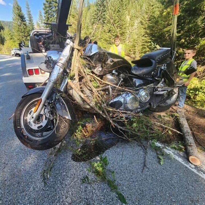
A concern of motorcyclists everywhere is how they might be located if they were to leave the roadway unseen. This issue was recently highlighted when a rider, on his way home from Sturgis, swerved to miss a deer and veered off the roadway. He went missing on August 11th, and authorities were notified on August 12th. The search team began looking on August 13th, and he was found on August 16th by his best friend’s parents, who had continued to search. 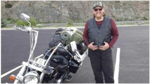
>Police report:
On August 13th and August 14th, the Idaho County Sheriff’s Office, along with the Idaho State Police, the Idaho County Sheriff’s Posse, the Idaho County Sheriff’s Office drone team, Idaho Fish and Game Officers, Missoula Life Flight, family, friends, and coworkers of Zachary searched the Highway 12 river corridor from milepost 75 through milepost 174 at Lolo Pass or the Idaho/Montana state line. The majority of the 99-mile search was done by breaking up into multiple teams and searching on foot on both sides of Highway 12, as well as the drone being used overhead to view the areas with harder-to-view access, and as Life Flight was flying the river corridor.
Idaho County Sheriff’s Office Dispatchers worked with Zachary’s cell phone company to ping his cellphone and were told it was not hitting a cell tower. All the ITD weather cameras through the upper end of Highway 12 take photos every 15 minutes, and after this information was accessed, it was determined that no usable information was obtained. There was also no evidence indicating a crash had occurred.
Over the coming days, the Idaho County Sheriff’s Office will be downsizing their search but will continue to have deputies monitor specific areas. Even though no debris has surfaced on the Lochsa and Clearwater River, some of the deeper holes along the river will have diving activity.
The Idaho County Sheriff’s Office would like to sincerely thank the Idaho State Police, Idaho Fish and Game, the Idaho County Sheriff’s Posse, Missoula Life Flight, the Idaho Transportation Department, Finley’s Tree Service, and the friends, coworkers, and family of Zachary who have assisted with the search. We would also like to share our deepest sympathy for Zachary’s family for what they are currently experiencing.
Coordinates from the Garmin led searchers to the Lost Creek Campground near milepost 136 on Highway 12.
First responders, including Kooskia Ambulance, Lowell QRU, Life Flight, an Idaho County Deputy, and the Idaho State Police, were dispatched to the scene. Upon arrival, Zachary Demoss was found alert and conscious, having survived by drinking water from a nearby creek. He was promptly airlifted by Life Flight to St. Patrick Hospital in Missoula for treatment.<
If you worry about loved ones ever getting lost, here are some free and paid services to consider.
Free Phone Apps:
Life 360
You can share your location with family and friends. Your location can be turned off and on for privacy, but seriously, why would you turn it off for those you trust and love? I have even used the app to find my phone when I left it somewhere. There is a paid “SOS” version, but the basic app is free. Some people complain that it wears their battery down more quickly. It is also dependent upon a cell signal.
Pro: Real-Time Location Sharing
Con: Dependent on Cellular Networks
What 3 Words
This is a free app based on a program that divides the world into 10×10-foot sections. Every 10×10-foot section is identified by 3 unique words. By giving someone your 3 words, they can locate you. This works best if both people have the What 3 Words app on their phones. However, it is also a good tool for those who care for vulnerable people or for use with anyone you know who struggles with technology.
Copy the link below and send it to the person you want to locate. When they open the link, they’ll be taken to a web page that displays the 3 words for their location. This page has been designed to require little data and should load even in areas with poor connections. They can then send you these words or give them to you over the phone.
Bookmark the link now so you can find it when you need it:?locate.what3words.com
Pro: Free, Accurate Location Sharing.
Con: Dependant on the Internet and GPS, Limited Public Awareness
Popular Devices:
SPOT—This is a satellite-based device with a paid subscription. It’s like your personal OnStar, but it’s also a tracker.
InReach by Garmin is a satellite-based device with a paid subscription. Its functionality depends on the level of subscription.
Pros: Reliable Communication in Remote Areas, Customizable Functionality Based on Subscription Level, Etc.
Cons: Subscription, and you need to share with someone who can then track your location; you need to be conscious to activate the SOS feature, and the device is actually relatively large and unlikely to be on your body, so it may not be “In Reach.”


In article on Personal Tracking Devices, an important resource was omitted. I use an app called Bubbler GPS Pro, which, when opened on my cell, records my location every 5 minutes automatically, and sends that location to a website called Spotwalla, run by an IBA member. Bubbler has free and paid versions (paid costs $10 per lifetime when I bought it); Spotwalla is an inexpensive subscription service. I set up a trip time frame in Spotwalla before I leave on a trip, and send a link to the trip page to my family and anyone interested in my trip. If anything happens (hitting a forest rat, for instance), the page will show my last location exactly, and give police and rescue personnel a very narrow search area. Also, with people watching my progress, if my track stops unexpectedly, people check up on me. This has helped me several times when I have broken down in remote areas; luckily no accidents yet.